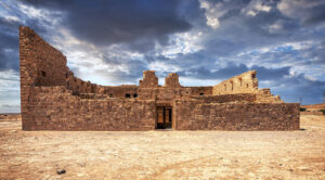
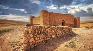
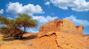
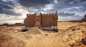
Rising prominently between Wadi Zarqa and its tributary, Wadi Huweijir, stands the historic Qasr Shebib, an Ottoman-era Hajj fort embodying architectural ingenuity and historical significance. Nestled next to the Zarka First Secondary School, this site is jointly maintained by the Department of Antiquities and the Ministry of Education, preserving its legacy for future generations.
A Masterpiece of Solid Construction
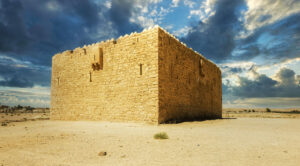
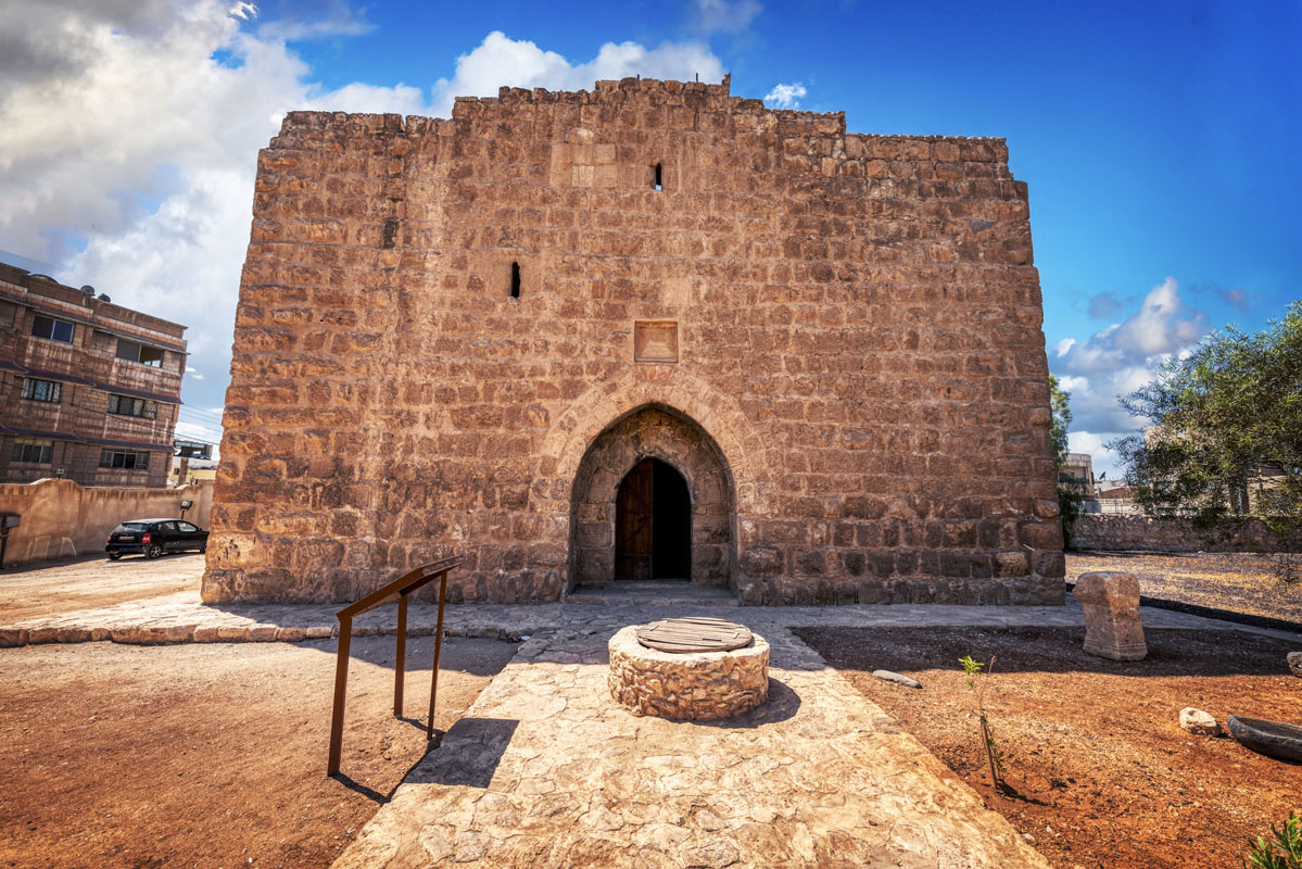
Qasr Shebib is a striking square structure, each side measuring 14 metres in length, with its walls constructed from enduring large limestone blocks—each approximately 0.5 metres in height and ranging between 0.5 to 1 metre in length. Many of these stones carry echoes of the past, likely repurposed from an earlier Roman structure. Intriguingly, the blocks feature rusticated centres framed by smooth borders, hinting at the craftsmanship of a bygone era.
Standing 8 metres tall above current ground level, the fort’s top showcases triangular crenellations on three sides—an addition believed to have been made after its original construction. On the southwest and east-facing walls, remnants of arrow slits, meticulously designed at 25 cm wide and 1 metre high, remain visible. These defensive features, now sealed, sit about half a metre above ground level, serving as a testament to the fort’s strategic and protective purpose.
The North Face – A Window into History
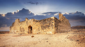
The north side of the fort commands particular interest. It houses the main entrance, flanked by two small yet functional lancet windows, which historically provided light to the internal staircase. These windows are simple yet effective in design, with gaps carved between two blocks and an arch-shaped cut in the stone above.
The entrance itself boasts a captivating design—a tall, pointed arch recess standing 3.5 metres high and 1.8 metres wide. Within this recess lies an arched doorway of similar proportions, framed by two courses of finely cut ashlars. Above the apex of the outer arch, a recessed limestone block once held an inscription, now lost, leaving visitors to wonder about the messages it might have conveyed.
Adding to its intriguing features is a concealed slot opening between the outer arch and the doorway. Measuring 0.2 metres wide and 2.8 metres tall, this opening reaches upwards to a height of 4.5 metres, aligning with the lancet window above. Historians believe this ingenious feature functioned as a concealed machicolation, allowing defenders to protect the entrance covertly.
Interior Elegance and Defence
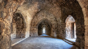
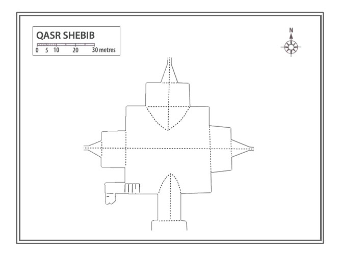
The entrance leads to a grand interior chamber with a barrel-vaulted ceiling, its impressive two-centre pointed form rising to approximately 6 metres at its peak. This chamber, running east to west, features deep recesses on its east, west, and south walls, where tall arrow slits—each standing 2 metres high—once reinforced the fort’s defensive capabilities.
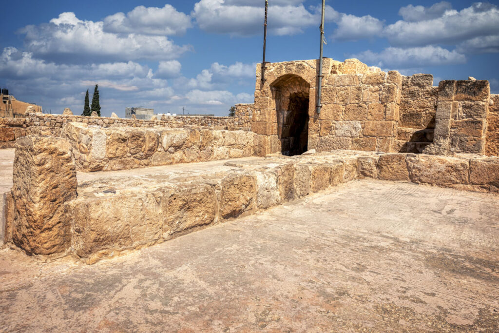
A staircase in the northeast corner connects the chamber to an upper level. This staircase is ingeniously embedded within the wall’s thickness and illuminated by the aforementioned lancet windows on the north façade. Traces of walls on the upper floor suggest it was divided into three sections—possibly two rooms flanking a central courtyard. The partially preserved remains of an arrow slit above the entrance further hint at the fort’s defensive architecture.
Evidently, the fort once stood taller, with the staircase’s continuation upwards pointing to the existence of a second floor, now lost to time.
Beyond the Fort – A Network of Cisterns
Outside the fort, a clever water management system reveals at least three cisterns, pivotal for sustaining life within the fort. Two are found to the east and another just 3.5 metres from the entrance on the north side. Each cistern features a square mouth (0.6 metres by 0.6 metres), bordered by bevelled stone kerbs, further showcasing the practical and durable nature of the design.
An Ode to Design and Legacy
Qasr Shebib is more than just an architectural relic—it is a window into the past, offering glimpses of Ottoman ingenuity and the strategic craftsmanship required to safeguard journeys along the pilgrimage routes.
Qasr Shebib, located in Wadi Zarqa, holds a rich and layered history that spans centuries. The site’s origins likely trace back to Roman times, as evidenced by a Latin inscription dated AD 253/9 discovered in the early 1900s. While the 13th-century writer Yaqut links the area to the Himyarite ruler Shebib Tubbai—potentially influencing the fort’s name—the current structure unmistakably dates to the Medieval period. Renowned as a caravan stop during the Mamluk era, it served as a vital waypoint on ancient trade routes.
Zarqa first appeared in Ottoman records in 1519 amidst peaceful interactions between Ottoman pilgrims and the Mafarija tribe. Explicit references to “Qasr Shebib” emerged later in 1563, noted as a stop in Mustapha Pasha’s itinerary. By the early 17th century, it had gained a reputation as a refuge, with Ali, son of Fakhr al-Din al Ma’ani, reportedly hiding there from the Sardiya tribe.
Various travellers documented their impressions of Zarqa. In 1709, Murtada ibn Alawan described it as an unclean and desolate stop, while Mehmed Edib, in 1779, found it abandoned but with flowing water and a fort. By 1812, the fort came into active use again as a base for Ottoman forces during conflicts with the Bani Sakher tribe.
Ayn al-Zarka gained attention during the Egyptian occupation in the 1820s, with officers under Muhammad Ali Pasha noting its abundant water supply and the fort’s dilapidated condition, prompting plans for repairs. Restored by the Ottoman authorities in 1899, it became a defensive post against Bedouin raids and a focal point for settlement. Shortly after, in 1903, 36 Chechen families were resettled around the fort, marking the beginning of a new chapter in its long history.
