
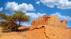
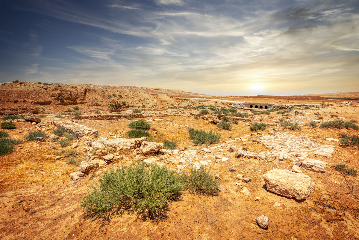
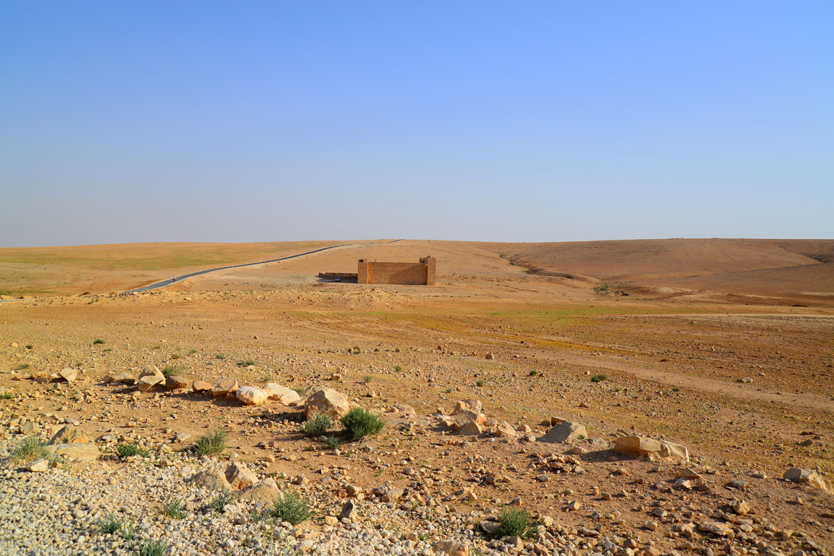
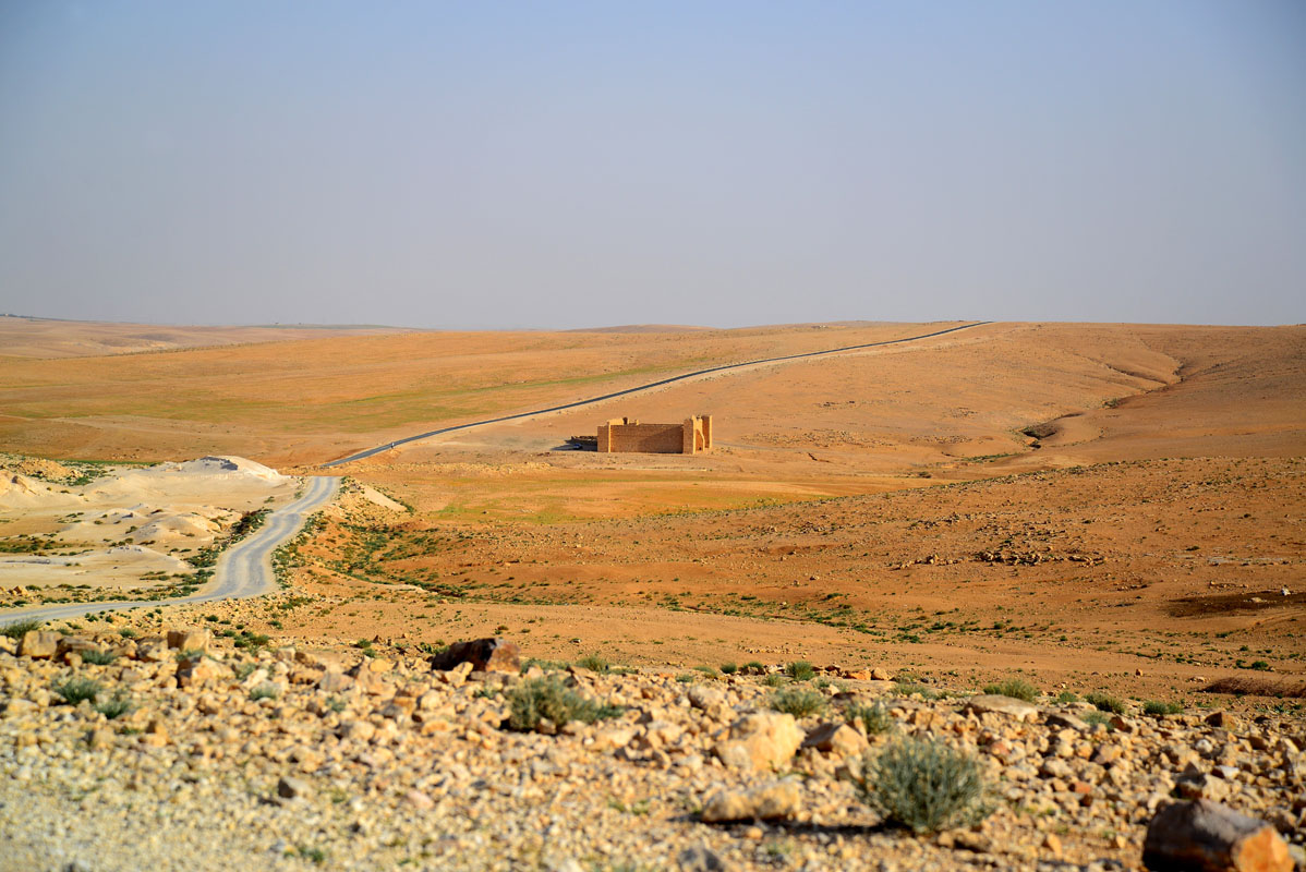
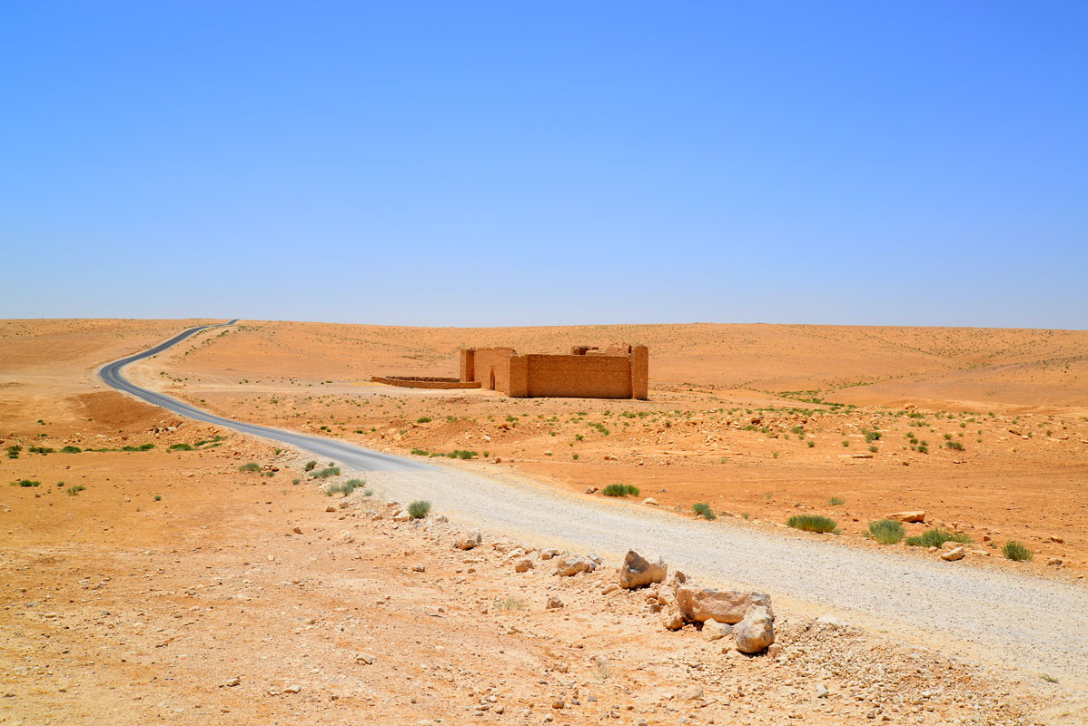
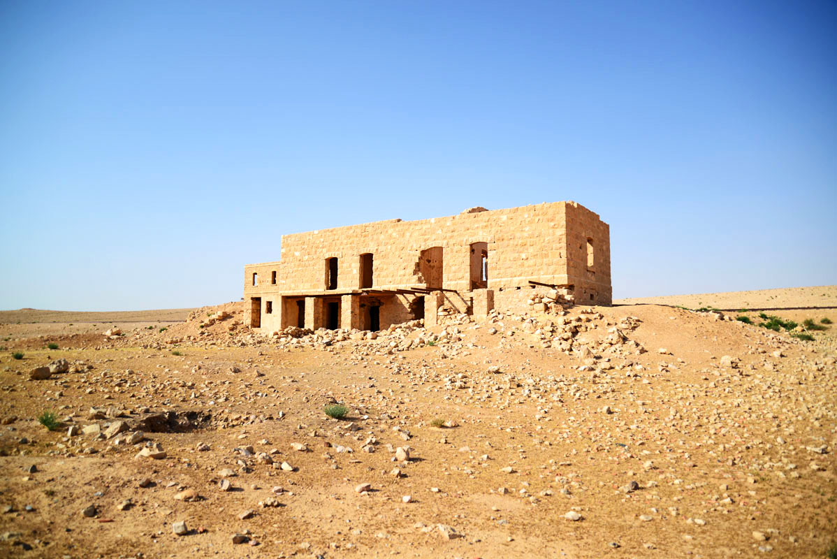
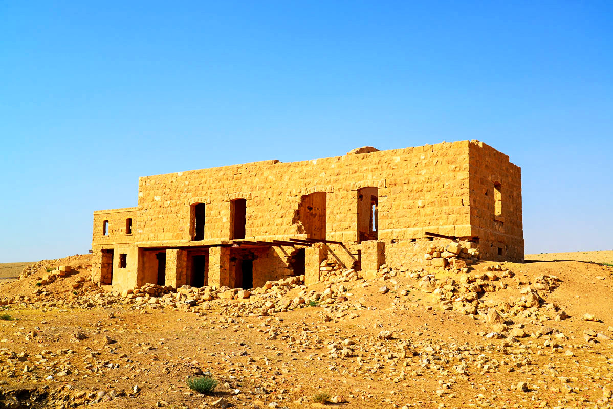
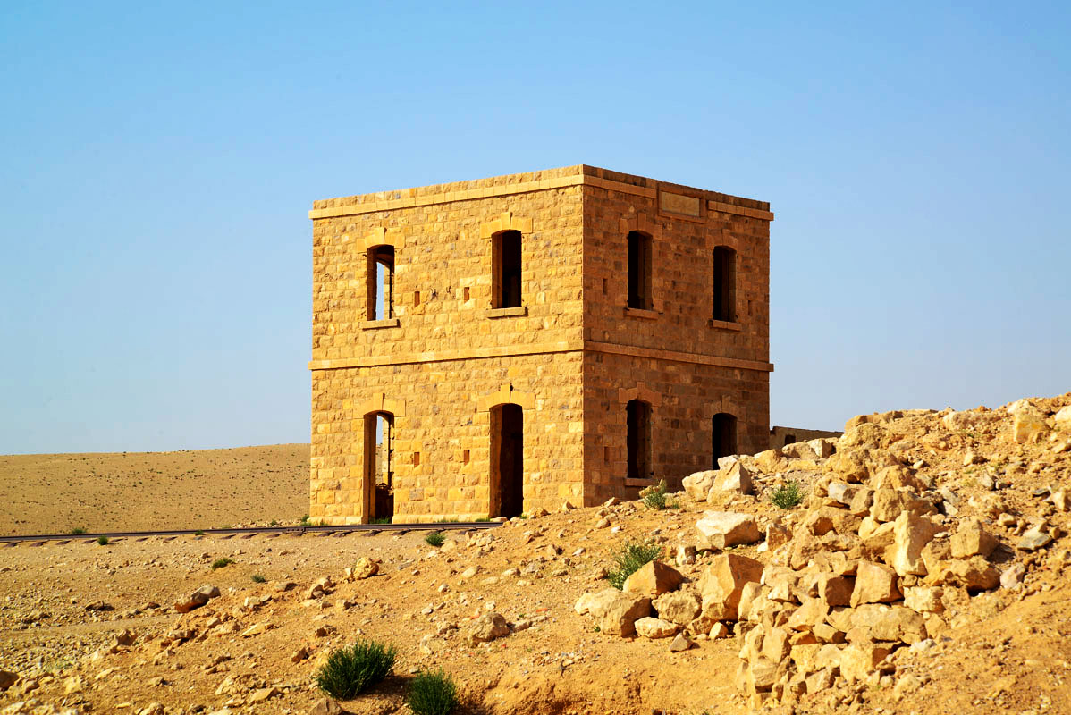
Qal‘at Dab‘a (previously Qal‘at Balqa‘) is located to the east of the Medieval Hajj road which passed through Zizia and appears to have been a stopping place on the way to Mecca, established in the Ottoman period. Today it is about 6.5 km to the east of Desert Highway and 1 km to the west of Dab’a Hijaz Railway Station.
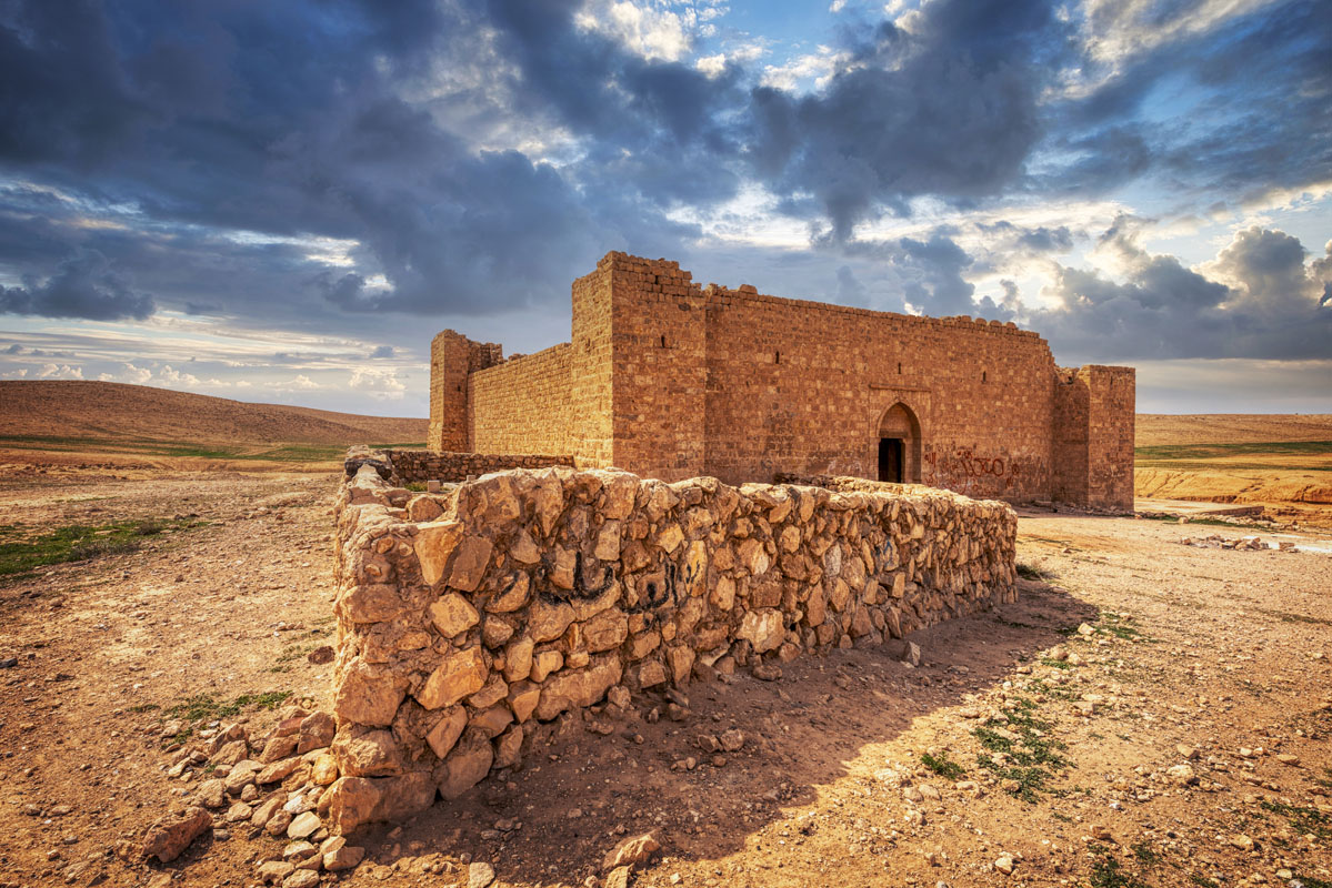
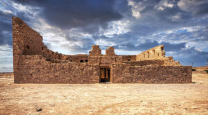
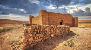
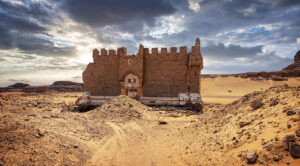
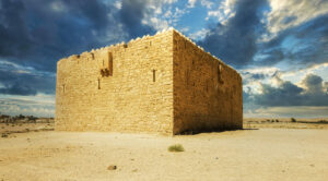
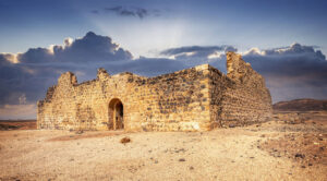
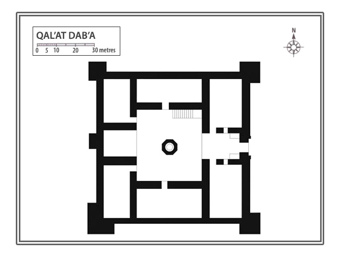
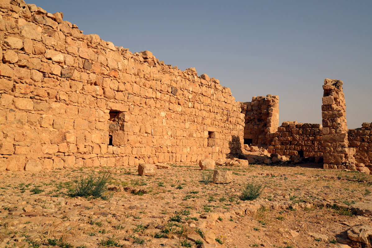
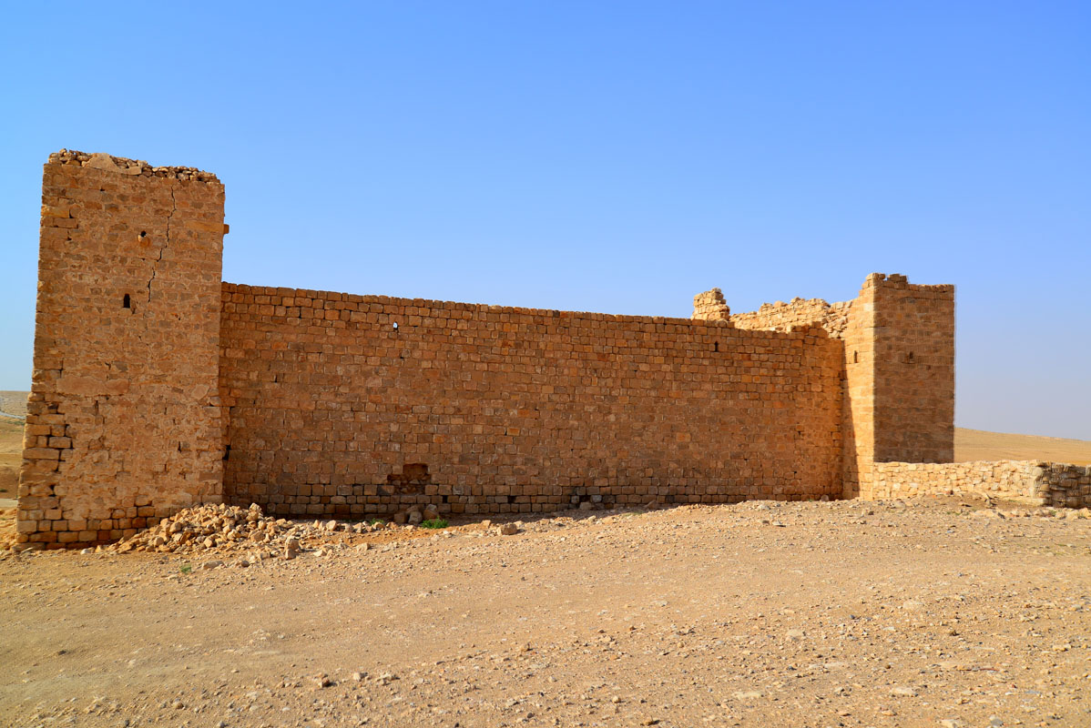
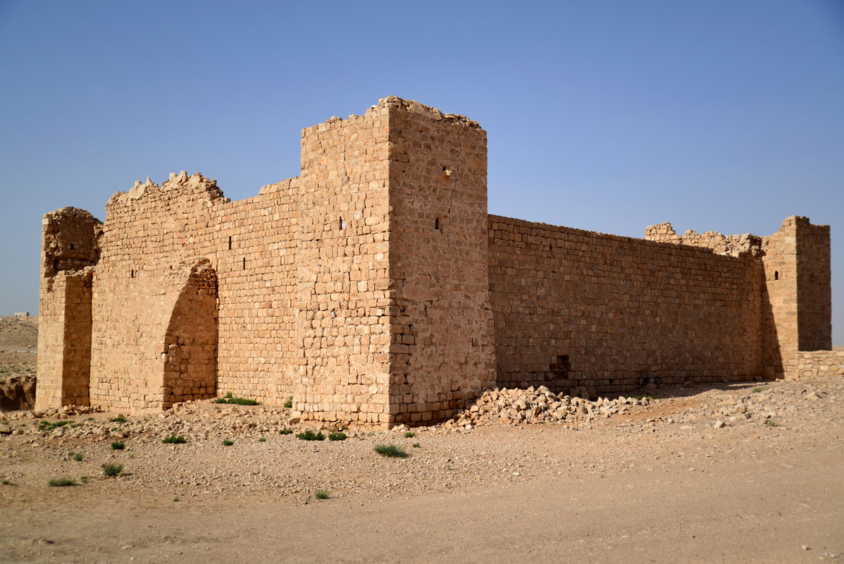
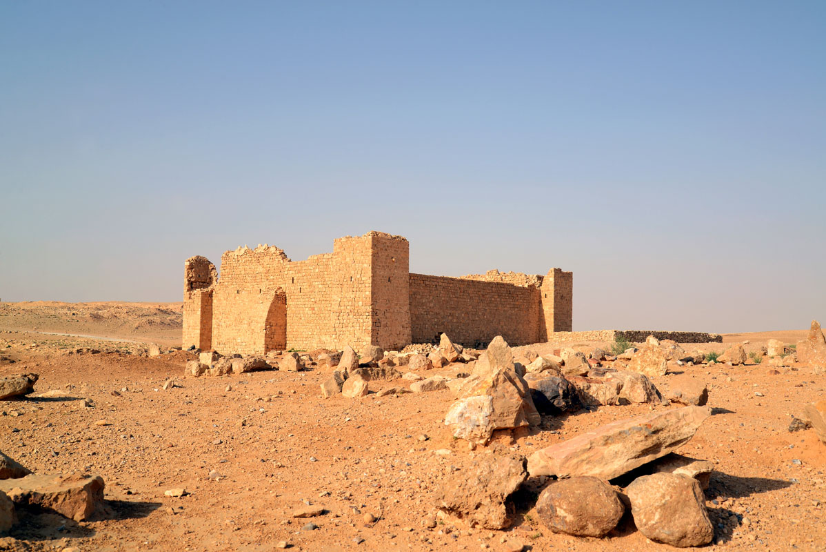
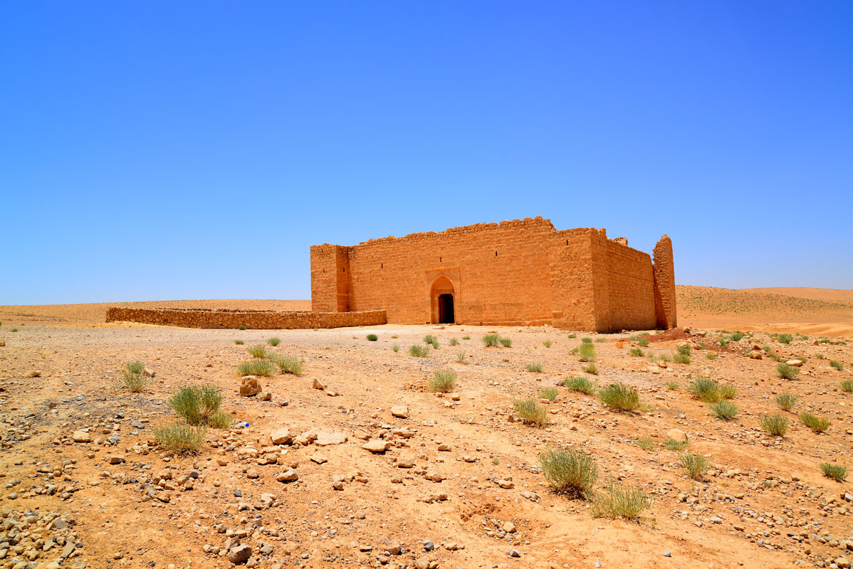
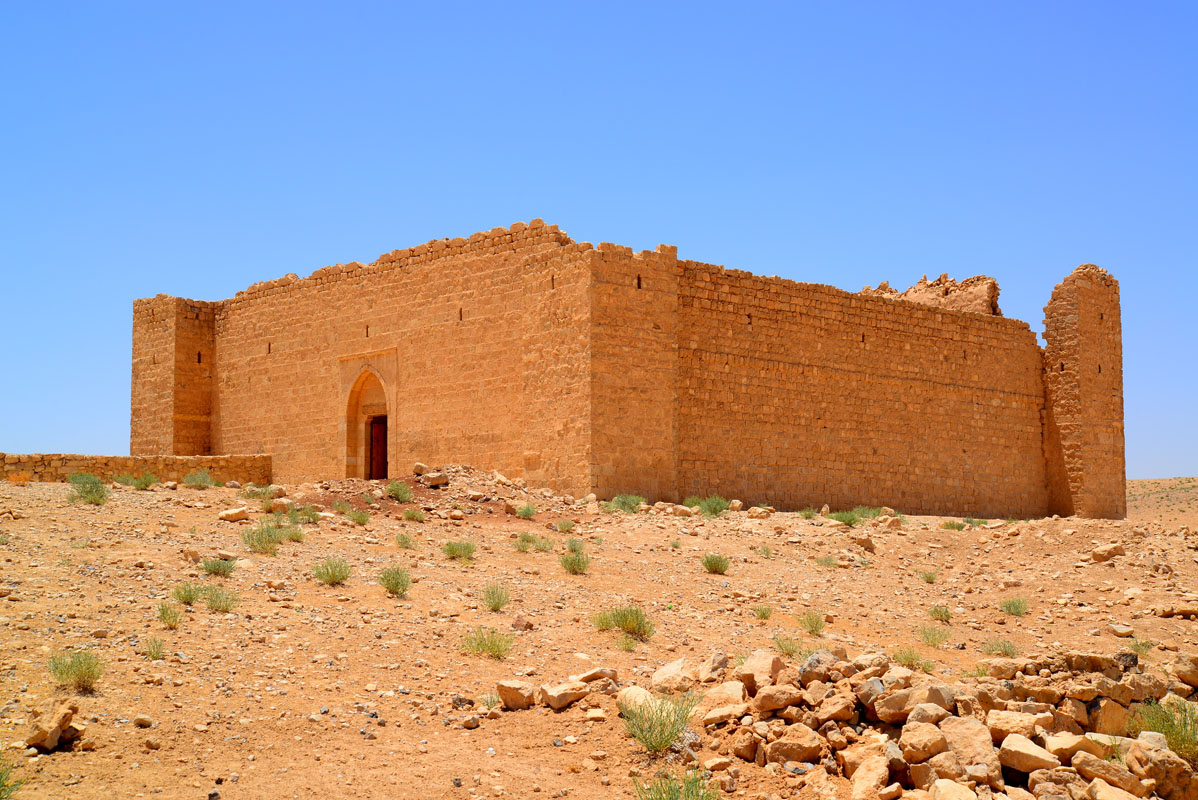
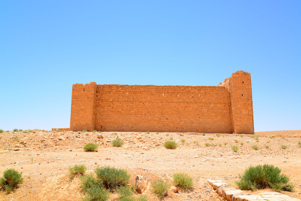
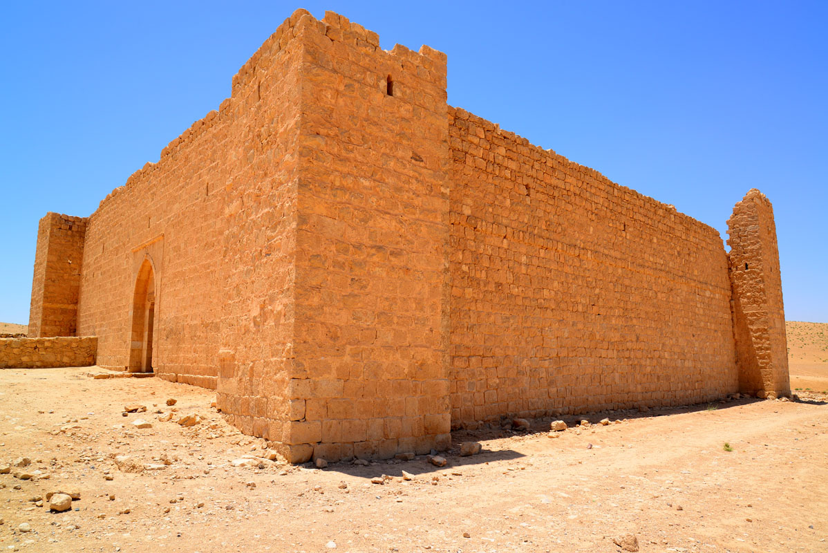
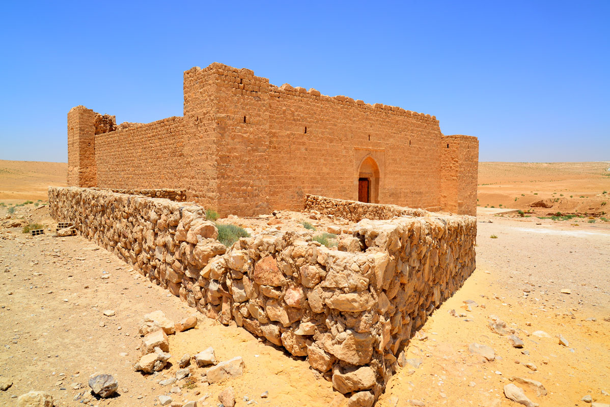
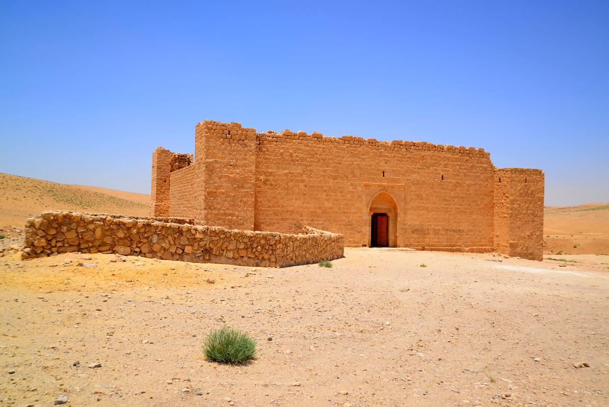
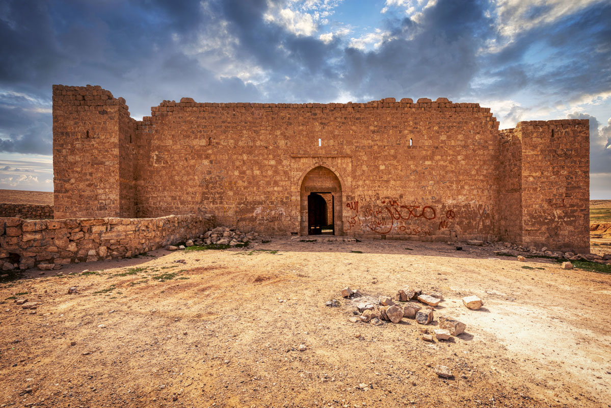
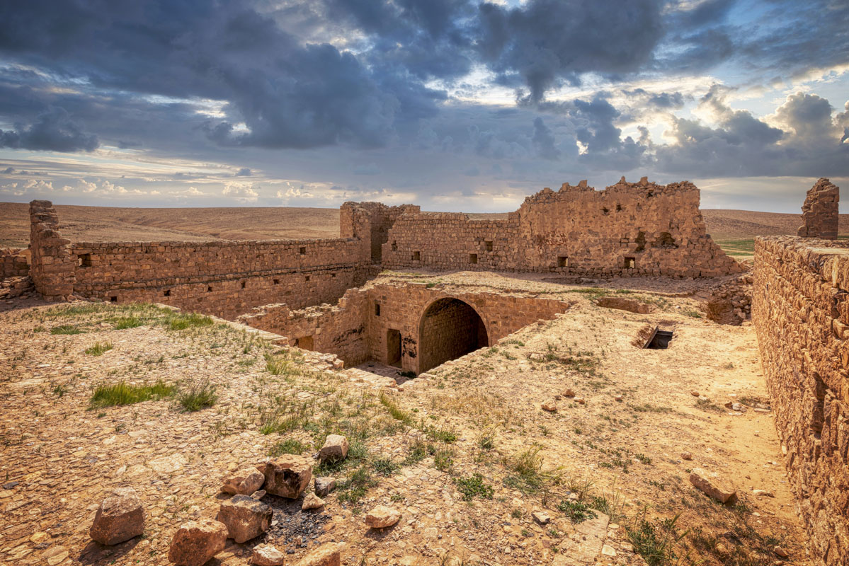
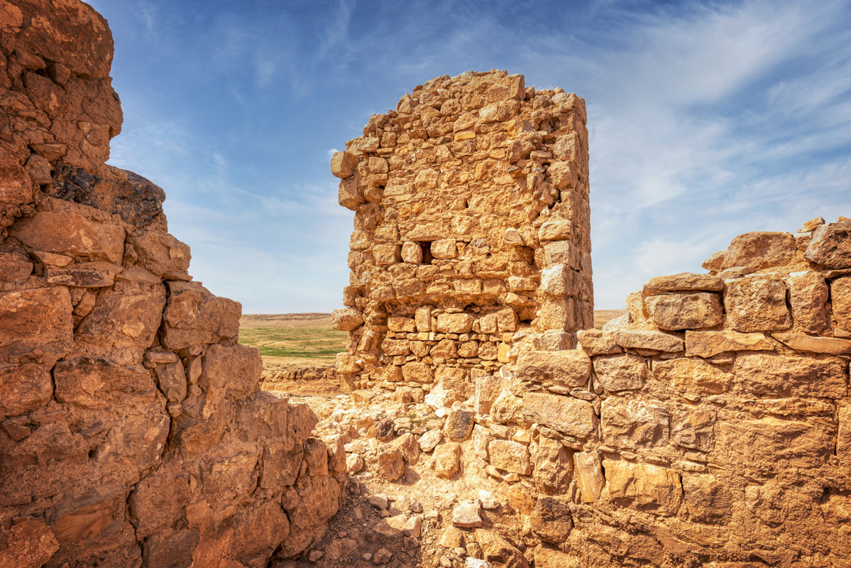
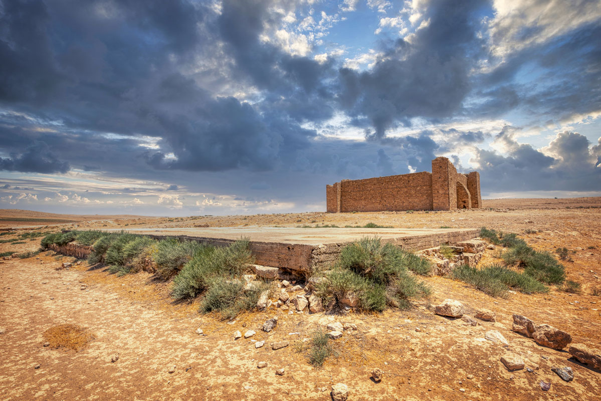
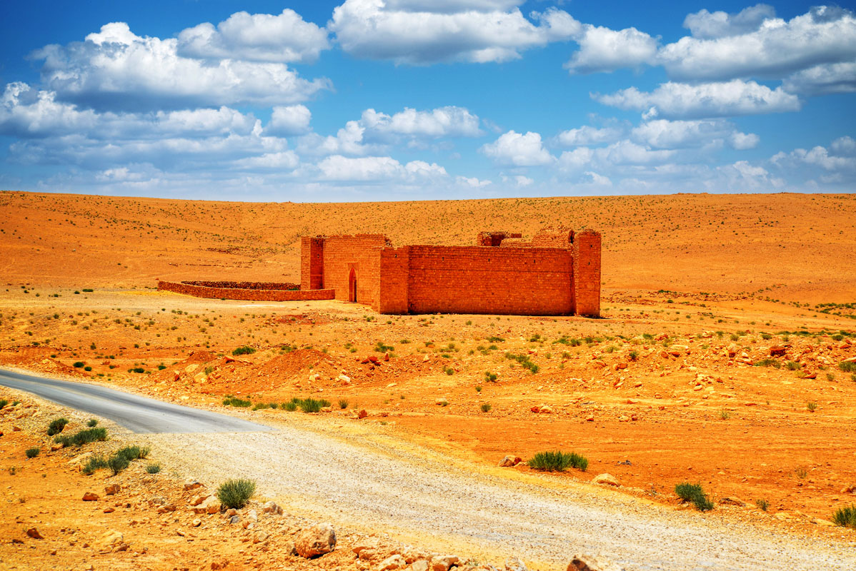
Lying next to the wadi, the site comprises a square fort and two cisterns. The fort is built on ground sloping down to the north. It measures about 25 m on each side and has four square corner towers with the entrance in the middle of the east wall. The entrance is set within a rectangular facade of dressed stone, with a tall, pointed arch. The two eastern towers are both 3 m high, whilst the south-western tower is the largest and tallest, measuring 4.2 m. Three of the towers have rainspouts that project away from the fort and resemble that inside.
The top of the walls preserves, in two places, the remains of crenelations – on the east side above the gateway and the west side to the left (north) of the buttress. On the east side, each crenelation has a tri-lobed form, composed of two finely dressed limestone blocks placed on top of the other.
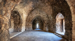
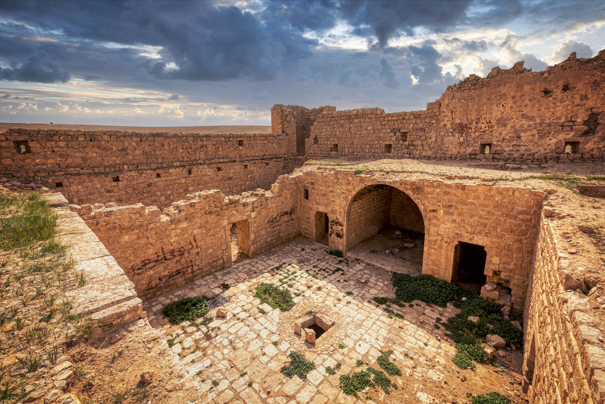
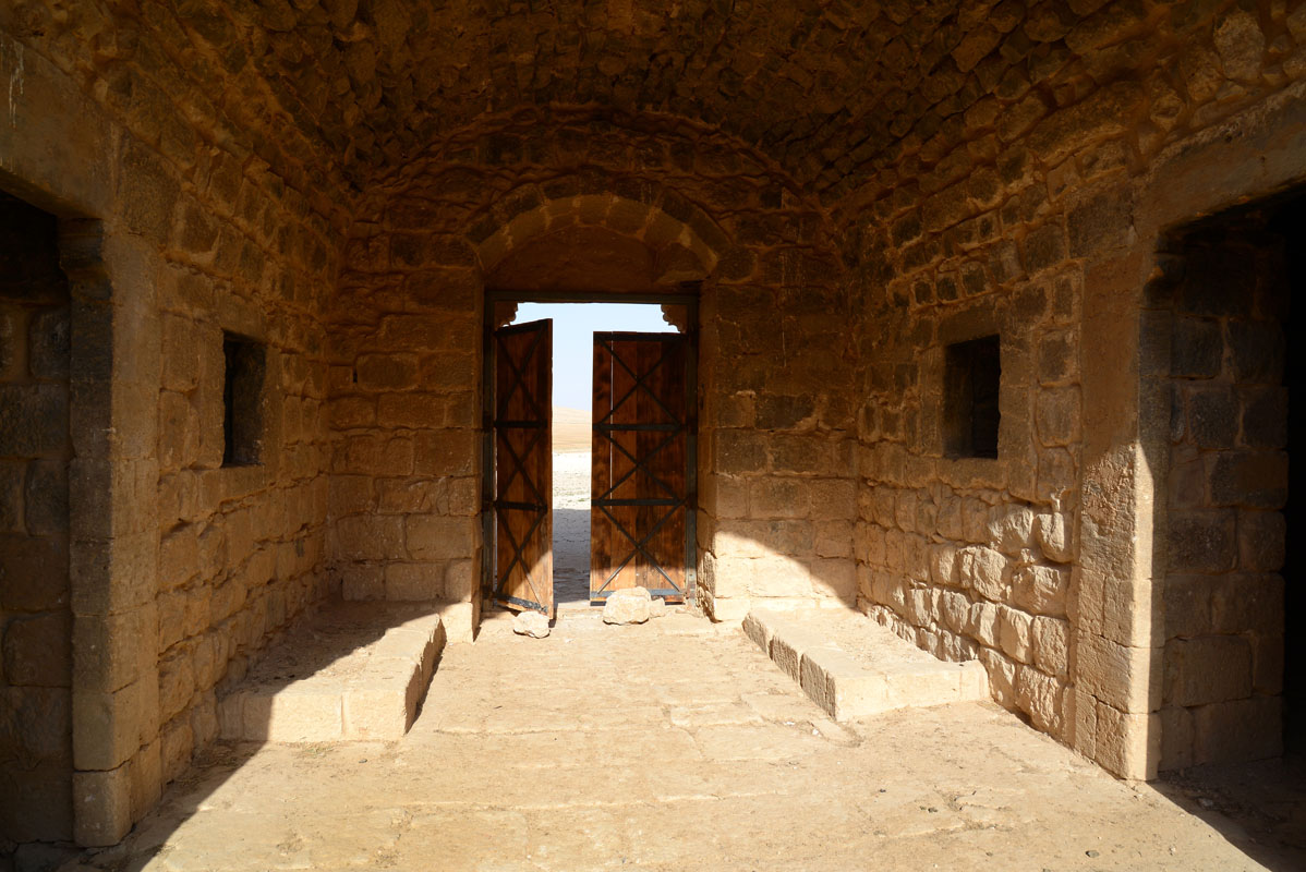
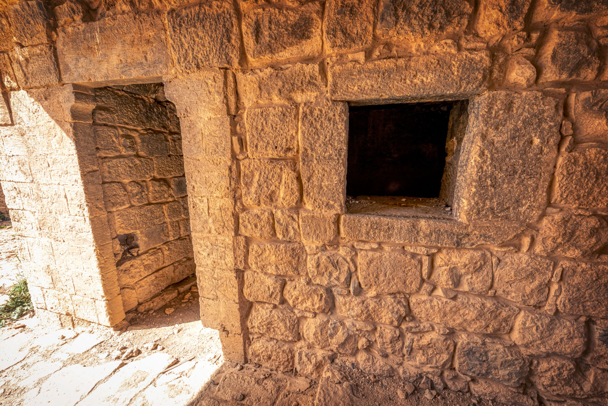
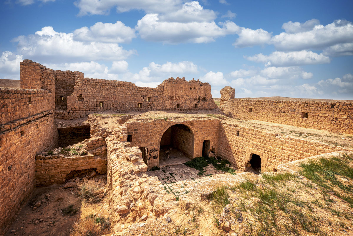
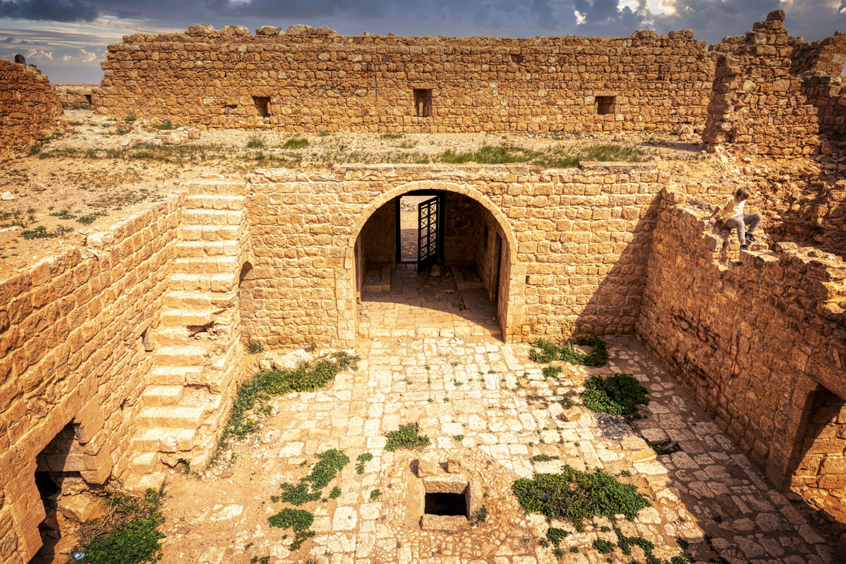
Immediately inside the gateway, there are two rectangular stone benches, one on each side. The interior of the gateway comprises a barrel-vaulted iwan leading to the central courtyard. On each side of the gateway, there is a window and a doorway leading into a large rectangular room. Each room is of identical size (7.0 m by 4.3 m) and covered with a barrel vault.
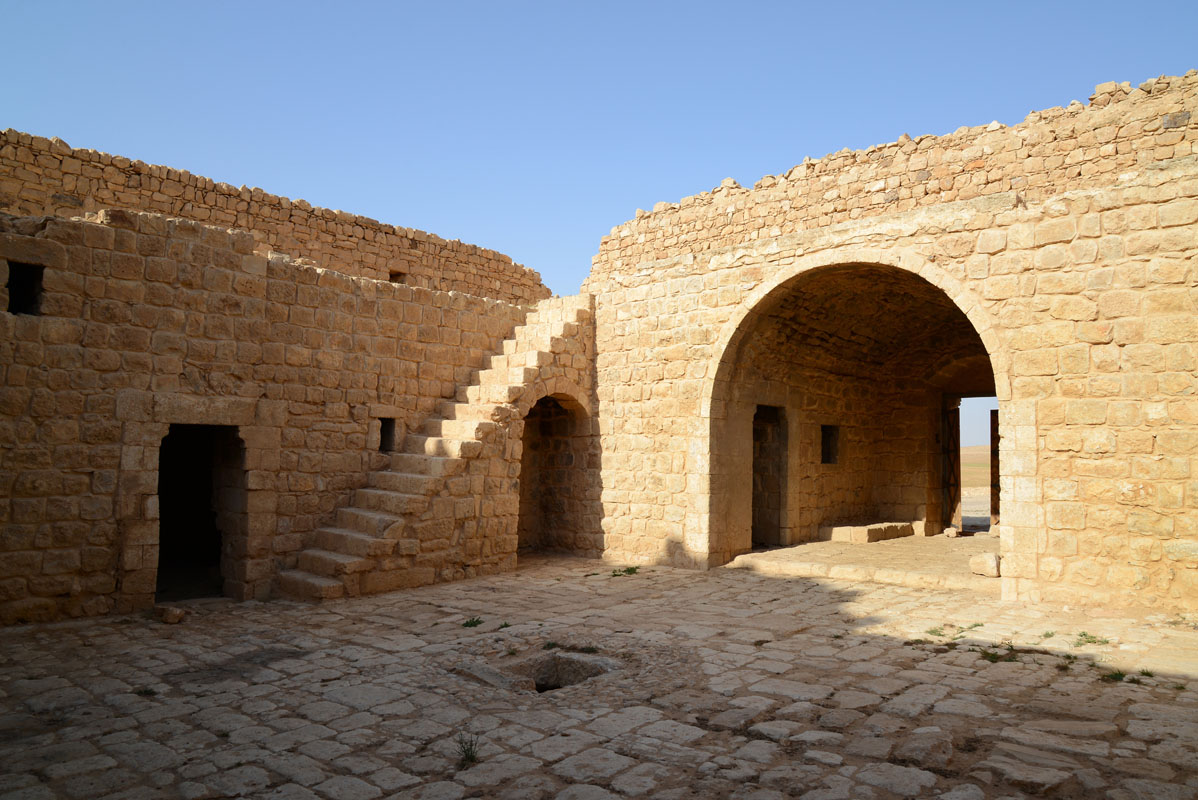
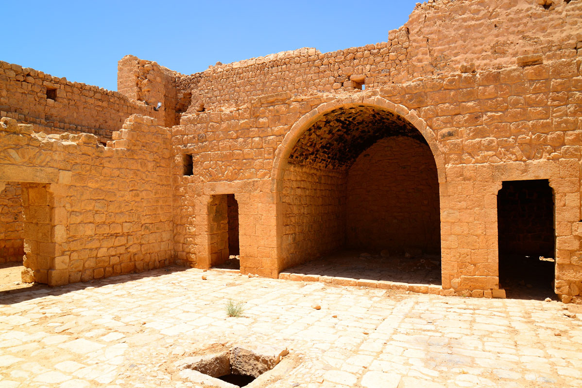
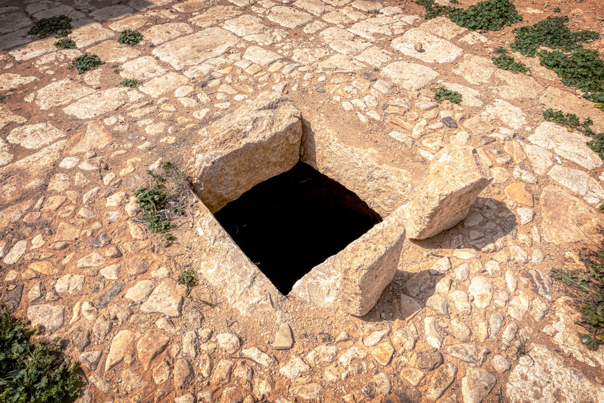
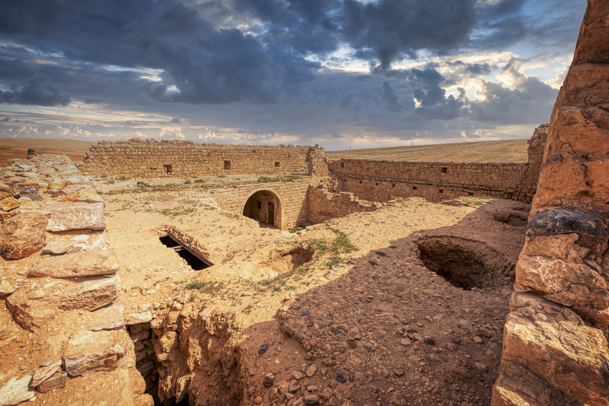
The central courtyard is a square area, paved with rectangular stones. In the centre of the courtyard, there is a circular hole which opens into a bottled shaped cistern. On the south side of the courtyard, there is a doorway leading into a rectangular room, originally covered with a barrel vault (now collapsed). The west side of the courtyard contains three openings, a large central iwan and two smaller doorways on either side. Each doorway leads into a rectangular room covered with a barrel vault. The north side of the courtyard features an external stairway leading to the upper floor and a doorway leading into a long rectangular room of similar size to that on the south side.
Unlike the other parts of the fort, this room has a tall flat roof supported by iron girders, though the setting for an original barrel vault can still be seen.
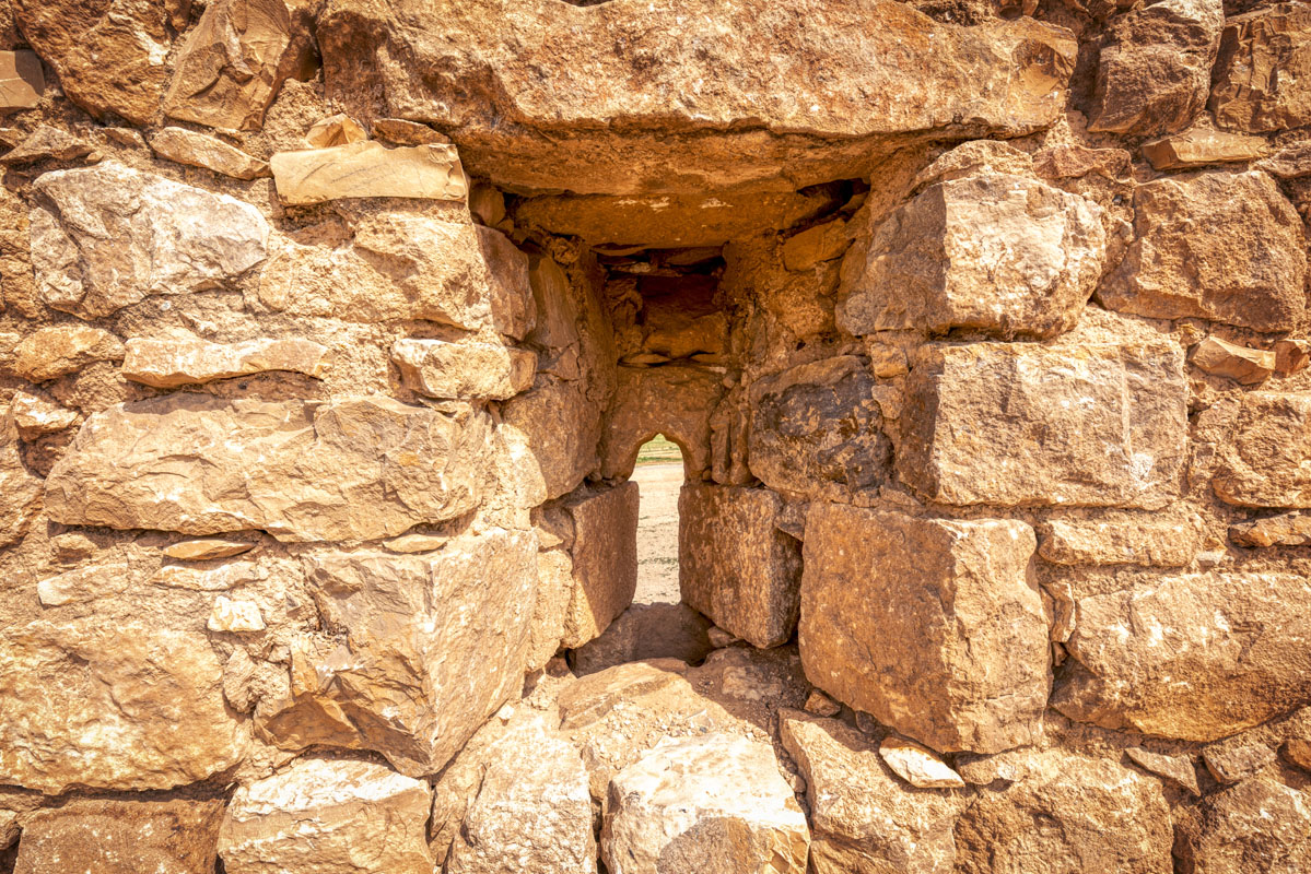
The stairs are made of dressed limestone blocks, built around a rubble core. There is a small arched niche beneath the highest part of the stairs (the stairs were destroyed after 1986 and rebuilt in 2004). There are now no rooms on the first floor, although there are the remains of a building on the southern side, which suggests a rectangular or square room. The surface of the first floor comprises a broad terrace, with flint cobbles laid over limestone rubble and earth. There were originally 8 rainspouts, two per side, projecting from the edge of the terrace into the courtyard. The exterior walls are pierced with small gun ports set low down. At each corner of the courtyard, there is a doorway into one of the towers. Originally each of the towers had a vaulted roof with a second storey, though all the vaults have collapsed. Access to the second storey of the towers was by a staircase, only one of which, at the north-east corner, has survived.
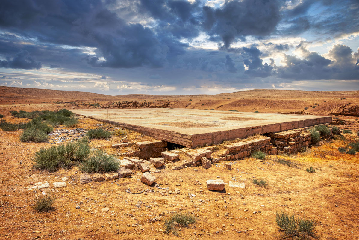
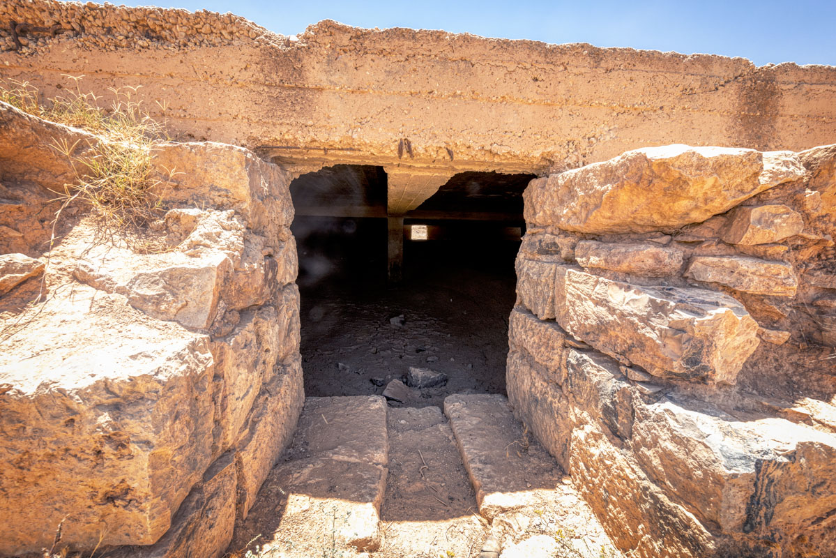
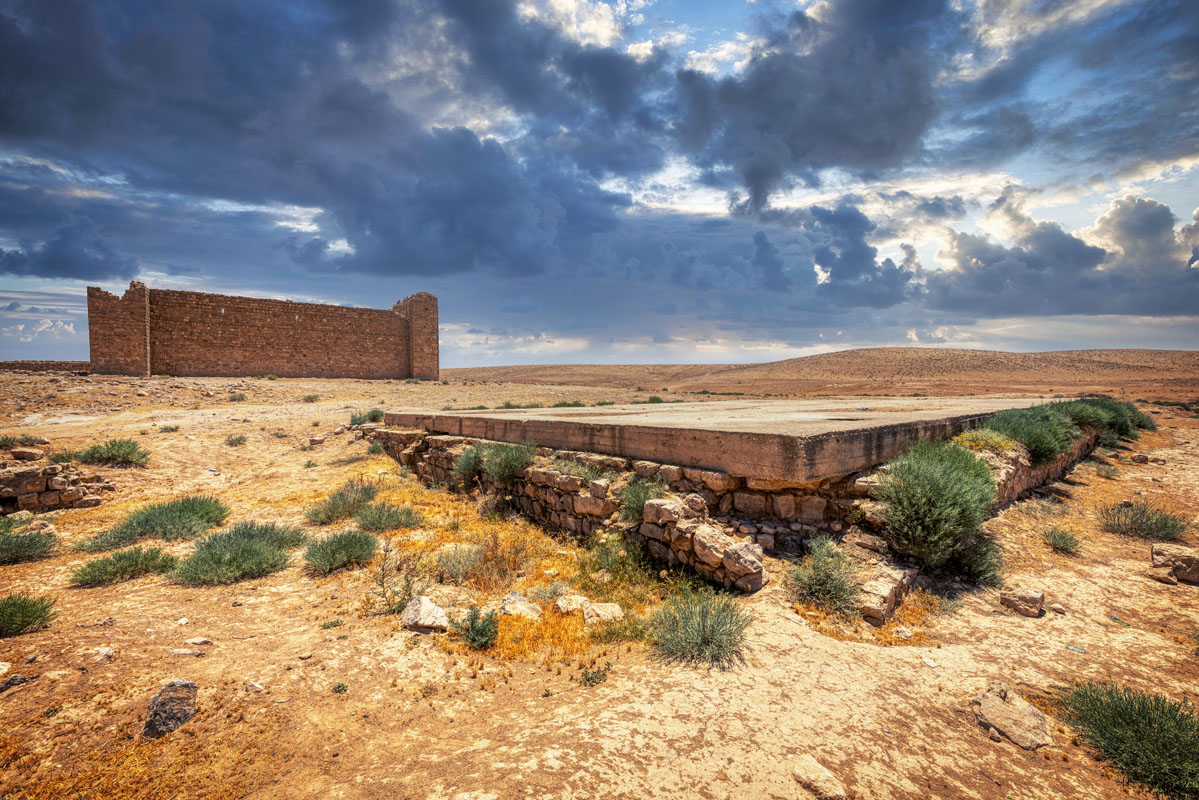
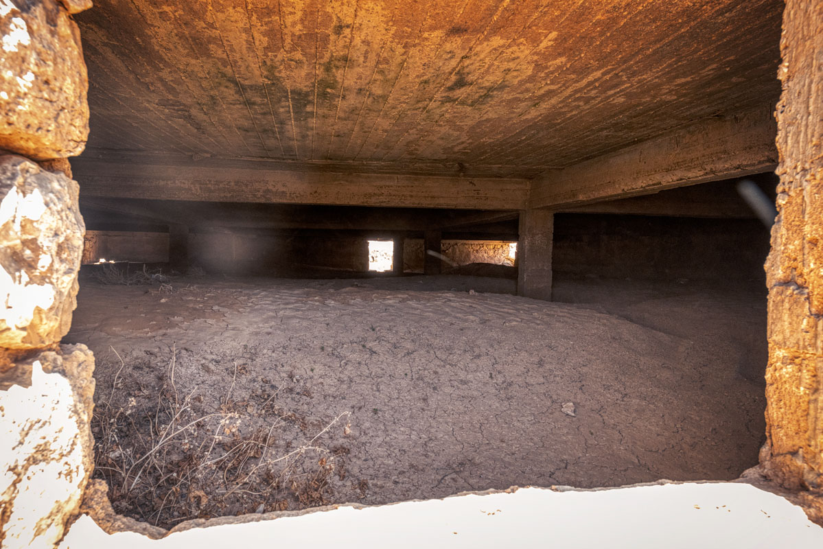
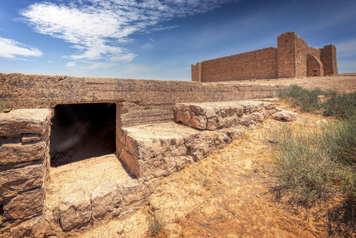
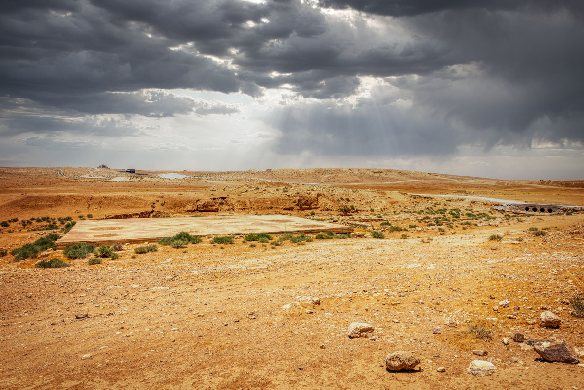
To the north of the fort, there are two rectangular reservoirs. The larger of the reservoirs (22.4 m by 21.2 m) is covered with a modern reinforced concrete roof, though the cistern itself is built of stone blocks and appears to be of a similar date to the fort. On both the south and north sides of the cistern, there is a surface of flint cobbles. At the southeast corner, there are a series of steps leading down into the water. At the west end, there is an opening, which appears to function as an overflow device, while a similar opening on the east side, appears to function as an inlet. The large reservoir is joined to the smaller cistern by a wide muddy channel. The smaller reservoir has a similar shape and has a set of steps leading down from the northwest corner.
Both the historical information about the fort and its appearance indicate a complex history, which began well before its restoration in 1767 and continues beyond the survey carried out in 1986. Probably the most notable aspect of the fort’s design is the four solid corner towers, which distinguish it from most of the other Hajj forts.
The modern name Qal‘at Dab‘a is a Bedouin name referring to the presence of hyenas in the vicinity of the fort, however, the original name of the fort was Balqa‘. The earliest Arabic reference to the site is by al-Baladhuri, who relates a story of how the Muslim general Yazid pursued the Byzantine army as far as a place called Dubiyya. However, the earliest unambiguous reference to the site is the 16th-century itinerary of Mustapha Pasha, which mentions Balqa‘ as a stop midway between Amman and Qatrana.
The first archaeological investigation of the fort took place in 1898 when it was surveyed by Brünnow and Domaszewski as part of their study of Roman Arabia. They observed that it was a modern construction, with a large cistern and took photographs of the interior and exterior. Most significantly they recorded an Arabic inscription, stating that it was re-built by the Amir al-Hajj ‘Uthman Pasha.
In May 1928, 10 years after the end of Ottoman rule, Qala‘at Balqa‘ was visited by Henry Field as part of the North Arabian Desert Survey. He described Balqa‘ as “a typical and perfect Haj fort”, which had been restored in 1767. Field particularly admired the “very fine wooden door” at the entrance and the cobbled parapet.


