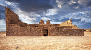
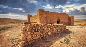
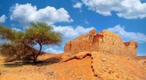
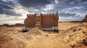
Nestled in the sandy desert of southern Jordan, just 15 km north of the Saudi border, lies an intriguing historic site that provides a glimpse into the region’s past. Surrounded by sweeping flat terrain and striking sandstone formations, this area is home to a Hajj fort, a large reservoir, and a stretch of cobbled road—all thought to date back to the 18th century.
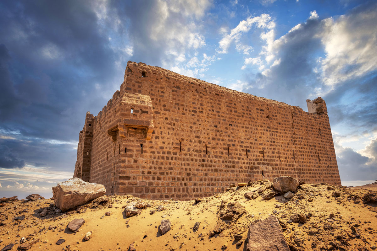
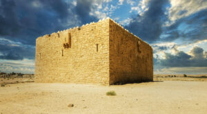
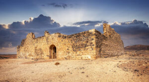
The fort, constructed from beautifully dressed sandstone blocks, rests directly on the sand as if floating atop the desert landscape. Its foundations fan outward, designed to give the structure stability in the shifting sands below. Interestingly, the walls of the fort taper as they rise, making the lower sections thicker than the upper parts. There’s a visual contrast between the north and west walls, which are taller, and the east and south walls, which suffered significant damage over time. The southern side, in particular, has partially collapsed due to extensive erosion.
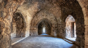
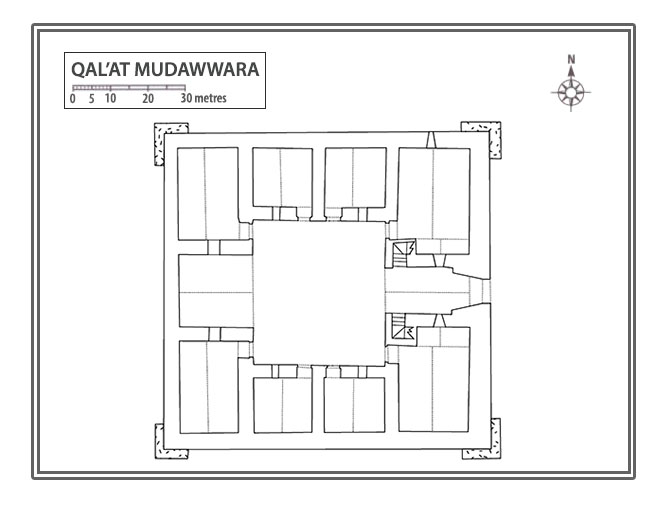
Visitors would enter the fort through a gateway at the centre of the east wall. This entrance, framed by massive sandstone blocks, features a lintel with a relieving arch and the remnants of a rectangular space above it—likely once home to a now-lost inscription. Above that, a large, projecting machicolation adds to the fort’s grandeur. Inside, a vaulted passage leads into a courtyard filled with the echo of history. Around the central courtyard lie nine barrel-vaulted rooms—symmetrically arranged—and above, accessible by staircases, are additional chambers offering windows that overlook the bustling space below.
Just 82 metres south of the fort stands the remnants of a large rectangular cistern. With its sandstone-lined interior and flint mix construction, this reservoir once provided vital water supplies to the fort and the surrounding region. Although today sand obscures much of it, you can still trace its impressive proportions, measuring over 31m in length.
Further afield, about 1.5 kilometres southeast of the fort, lies a cobbled road stretching over 500 metres. Crafted from flint cobbles and edged with sandstone, this road—likely built to aid travel through the desert’s unpredictable sands—demonstrates the ingenuity of those dedicated to easing the pilgrim’s path to sacred destinations. Its construction mirrors techniques used in similar roads, suggesting it was an essential part of the fort’s development.
Unlike many ancient sites, this fortified complex remained in use until the 1950s, meaning its features were often adapted and modernised to suit changing needs over the years. Despite this, it stands as a fascinating link to the past, preserving its unique blend of resilience and practical ingenuity.
This captivating glimpse into 18th-century desert life invites you to imagine the travellers who once sought refuge here, the conversations that echoed through its stone chambers, and the determination that shaped its enduring story in the sands of time.
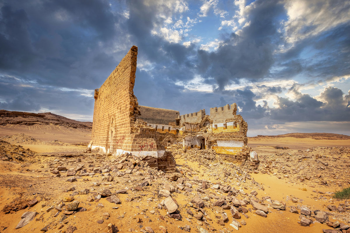
The site gained historical significance as an important stop along the Syrian Hajj route, first mentioned in the 9th century by Ibn Khurdadhbih. By the 16th century, it appeared in Mustapha Pasha’s itinerary as Tubaylayat, and later in 1672, Evliya Celebi referenced it as Kudrat Jugayman. Celebi described its striking rock-cut fort with no visible entrance, perched near a well called Asma, likely named after Suleiman Khan’s sister.
During the 18th century, under the direction of Damascus Governor Aydinili Abdullah Pasha, a fort and two cisterns were constructed at al-Mudawwara, an area known for its scarce water supply. Notably, Mehmed Edib described the area as dominated by shifting sands resembling an endless ocean, with water found only near the fort.
By the 19th century, the site, referred to as Mudawwara in a report to Muhammad Ali Pasha, featured a square fort and two cisterns—one small and one large. However, challenges persisted with a low water table and sand frequently filling the cisterns.
Its strategic location came into play during the First World War, when intense fighting occurred. British and Arab forces launched attacks from Aqaba, aiming to neutralise its use by Turkish forces for assaults on Palestine.
Rich in history and marked by its rugged landscape, Mudawwara stands as a testimony to centuries of human activity and resilience in the harsh environment of the region.
